Carlsbad fire map, road closures: Poinsettia brush fire burns 30 homes in California

UPDATE: Roads have been closed as the brush fire in Carlsbad continues. The following is the list of roads closed due to the fire:
Aviara Parkway from Ambrosia Lane to El Camino Real
El Camino Real from Alga Road to Palomar Airport Road
Camino Vida Roble between Palomar Airport Road and El Camino Real
Poinsettia Lane from Black Rail Road to El Camino Real
Palomar Oaks Way
==
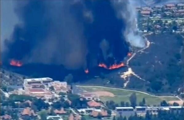
Another brush fire is blazing through California today.
A brush fire, exacerbated by gusty winds and dry conditions, has been burning through Carlsbad Wednesday, burning down homes and prompting thousands of residents to evacuate.
Schools were evacuated, including tourists visiting the Legoland amusement park nearby.
The Carlsbad fire broke out just after 10.30 a.m. Wednesay morning, near Poinsettia Lane and Alicante Road. The cause of the blaze is unknown, but the flames grew quickly, reaching residential neighborhoods and businesses.
So far, 30 homes have reportedly been destroyed - with the fire spreading over 100 acres. Multiple power lines are also down.
Over 11,600 residences and businesses were ordered to evacuate.
Evacuation shelter locations have been set up at the Calavera Hills Community Center at 2997 Glasgow and the Westfield Plaza Camino Real at 2525 El Camino Real.
Schools evacuated are Aviara Oaks elementary and middle schools and Poinsettia Elementary school.
The Carlsbad fire comes a day after 20,000 residents were ordered to evacuate in Bernardo, San Diego, on Tuesday. The evacuation order has since been lifted.
See the interactive map of the fire below:
View California Fire Map in a larger map